Tactile Map Miami Lighthouse for the Blind
About this project
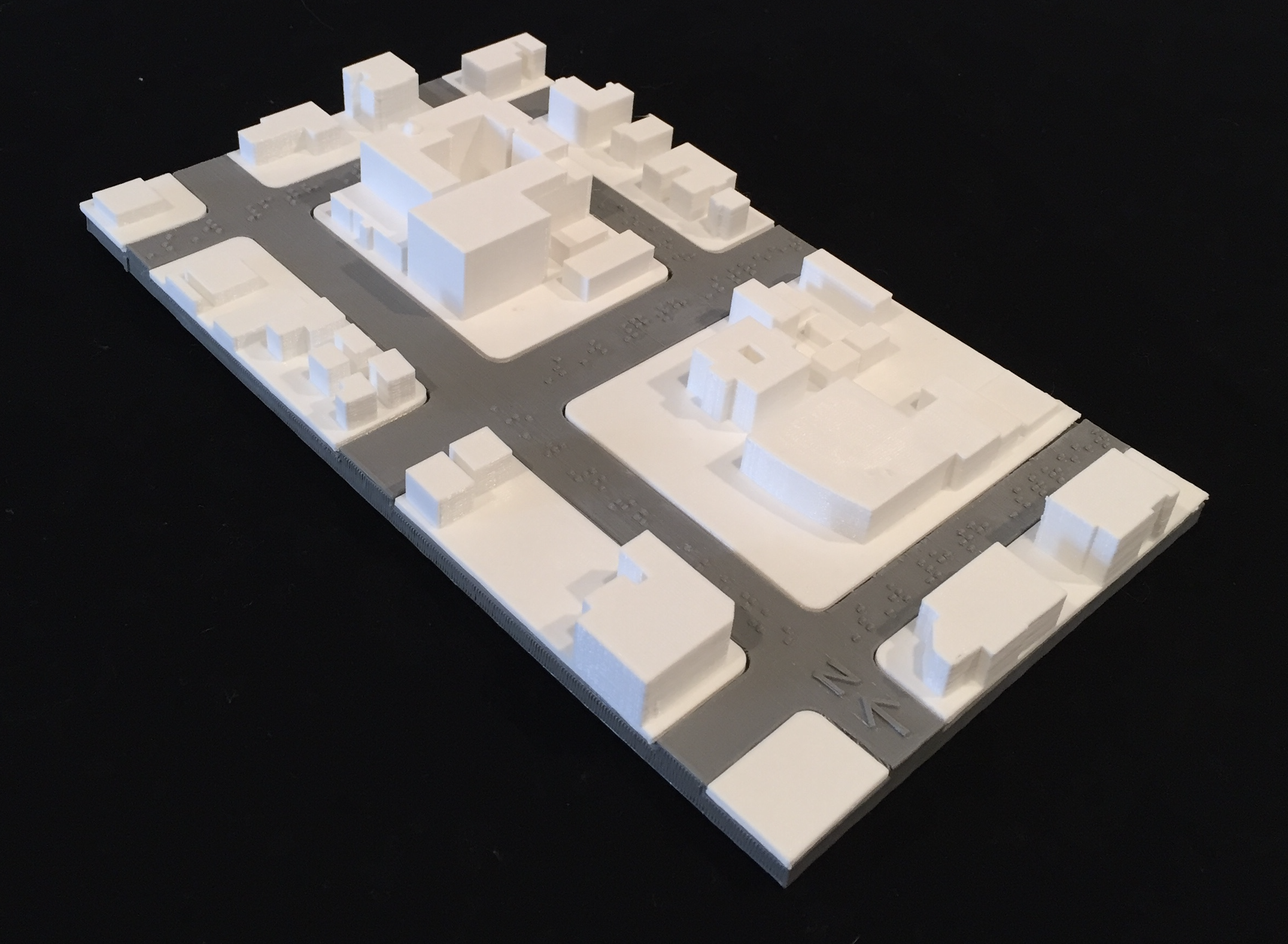
Over the course of 2018 and 2019 we worked with need knowers to create 3D printed tactile maps representing the streets and buildings around the Miami Lighthouse for The Blind. In this model, one can sense the location and form of the Lighthouse headquarters, the forms of the structures around the Lighthouse for The Blind, the north arrow, and braille stating the streets.
The challenge
The challenge was to design and make 3D printed tactile maps representing the streets and buildings around the Miami Lighthouse for The Blind. In this model, one can sense the location and form of the Lighthouse headquarters, the forms of the structures around the Lighthouse for The Blind, the north arrow, and braille stating the streets.
Who it helps
Miami Lighthouse for the Blind and Visually Impaired clients want better ways to complete their mobility and orientation workshops.
How it works
For more information on the Tactile Map and related files, see the FIU Digital Commons .
Project details
- Stage: Concept
- Built by the Florida International University community, Miami, Florida, United States of America
- Team: Tactile Map
- Category: Daily Living
- 2 downloads
The build files for Tactile Map Miami Lighthouse for the Blind are free to download from this page - open source, shared by TOM: Tikkun Olam Makers.
Related projects
Browse all TOM projects · Search projects · TOM communities · Makeathons and events